
3D Digital Twins & City Models for Councils
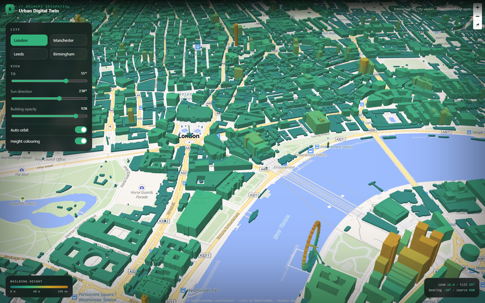
A digital twin is a working 3D model of a real place, in the browser, with your own data on top. We build them from OpenStreetMap and Ordnance Survey building footprints, LiDAR and terrain data, and your own site boundaries, allocations or asset records. Real extruded buildings, height-coloured massing, terrain, sun and shadow studies, and layers a committee or a resident can toggle without training. No desktop GIS licence, no login wall, no plugin: it opens on a laptop, a tablet or a phone.
Why UK councils and local-authority teams pick BozApps for 3d digital twins & city models
UK councils are sold expensive proprietary GIS platforms by vendors who don't understand local-authority procurement, accessibility regulations or public-sector budgets. BozApps (with parent firm Bozmaps) builds on open standards (MapLibre, OpenStreetMap, Ordnance Survey OpenData) with WCAG 2.2 AA baked in and a fixed-price commercial model that fits council budgeting.
Bozmaps geospatial heritage: open-source map stack, no proprietary lock-in
WCAG 2.2 AA accessibility built in from day one, audited at launch
Welsh-language parity available for Welsh authorities
Public-sector accessibility statement template included
Source code lives in your GitHub org, so you exit clean if you ever in-house
Fixed-price discovery, fixed-price build, predictable monthly operations
Good for councils…
- Local authority planning and regeneration teams
- Urban design and masterplanning consultancies
- Developers presenting a scheme to a committee or the public
- Universities and research groups working on the built environment
What you'll get
- A browser-based 3D model of your town or city, no software to install
- Real buildings from OpenStreetMap, OS OpenData and LiDAR, with proper terrain
- Your own layers on top: sites, allocations, boundaries, constraints, assets
- Sun and shadow studies, height and massing colouring, tilt and orbit views
- Public-facing consultation mode alongside an internal team view
- WCAG 2.2 AA accessibility, hosted and maintained by us if you want it
Councils case studies
Real projects we've delivered for uk councils and local-authority teams.
Other services for councils
- Mobile Apps for Councils
- SaaS & Web Platforms for Councils
- Geospatial & GIS for Councils
- Websites & Marketing Sites for Councils
- Hosting & Long-term Operations for Councils
- AI Features & Automation for Councils
- SEO & Search Rankings for Councils
- GEO: Get Found by AI Assistants for Councils
3D Digital Twins & City Models for other UK industries
Building 3d digital twins & city models for councils? Let's scope it.
30-minute call. Written proposal within five working days. Fixed price wherever the scope allows.