GIS & Geospatial Software for Councils
Web maps with MapLibre GL, Leaflet, Mapbox or OpenLayers. Spatial analysis with QGIS, PyQGIS, GeoPandas and GDAL. Drone survey processing. Satellite imagery analysis on Google Earth Engine. We bring real GIS rigour — CRS handling, projections, OS / OSM / ONS / Copernicus data — and ship it as something a non-technical user can operate.
Why UK councils and local-authority teams pick BozApps for geospatial & gis
UK councils are sold expensive proprietary GIS platforms by vendors who don't understand local-authority procurement, accessibility regulations or public-sector budgets. BozApps (with parent firm Bozmaps) builds on open standards — MapLibre, OpenStreetMap, Ordnance Survey OpenData — with WCAG 2.2 AA baked in and a fixed-price commercial model that fits council budgeting.
Bozmaps geospatial heritage — open-source map stack, no proprietary lock-in
WCAG 2.2 AA accessibility built in from day one, audited at launch
Welsh-language parity available for Welsh authorities
Public-sector accessibility statement template included
Source code lives in your GitHub org — exit-clean if you ever in-house
Fixed-price discovery, fixed-price build, predictable monthly operations
Good for councils…
- Local authorities and planning consultancies
- Environmental and engineering teams
- Tourism boards and event organisers
- Research institutions and NHS commissioners
What you'll get
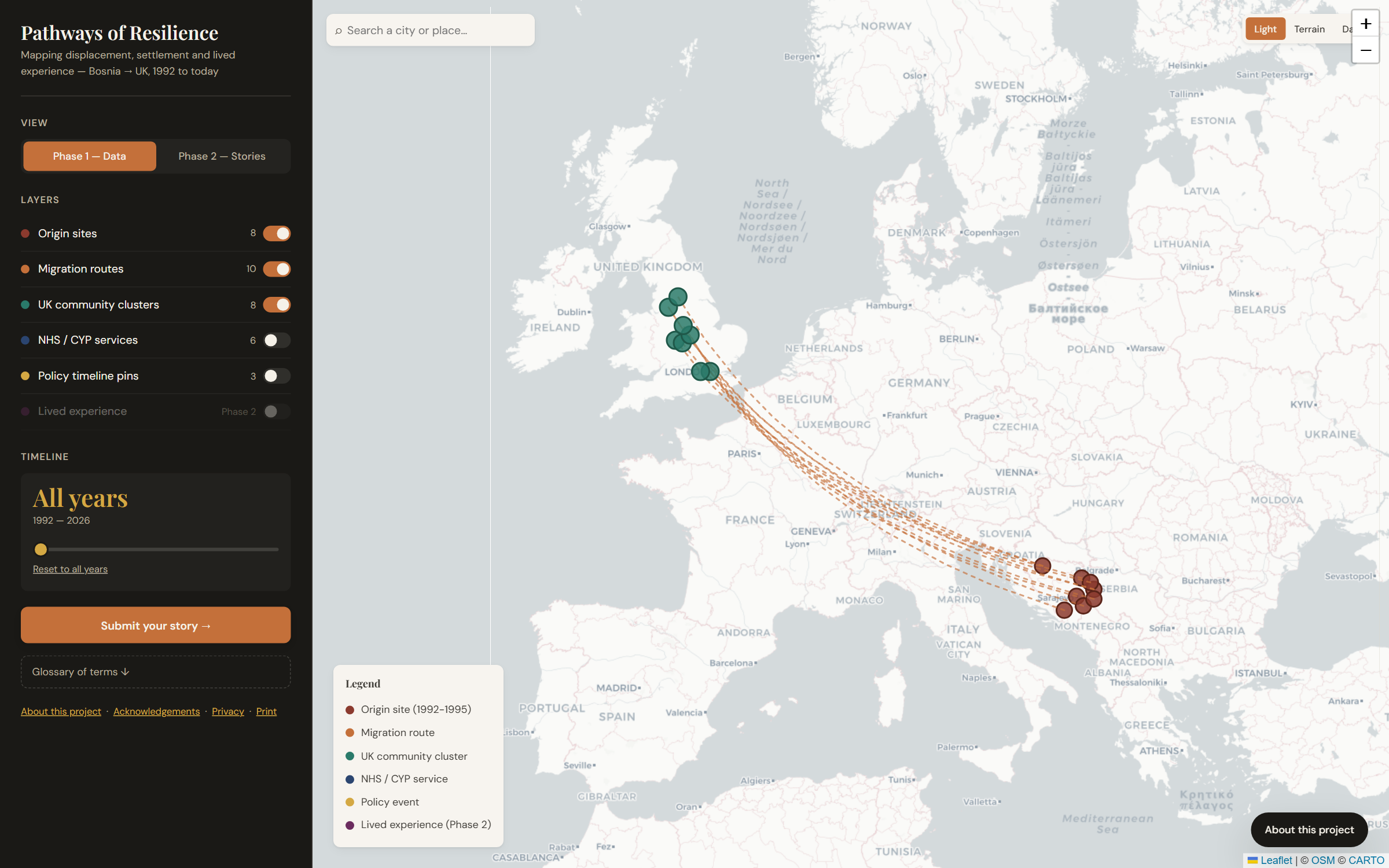
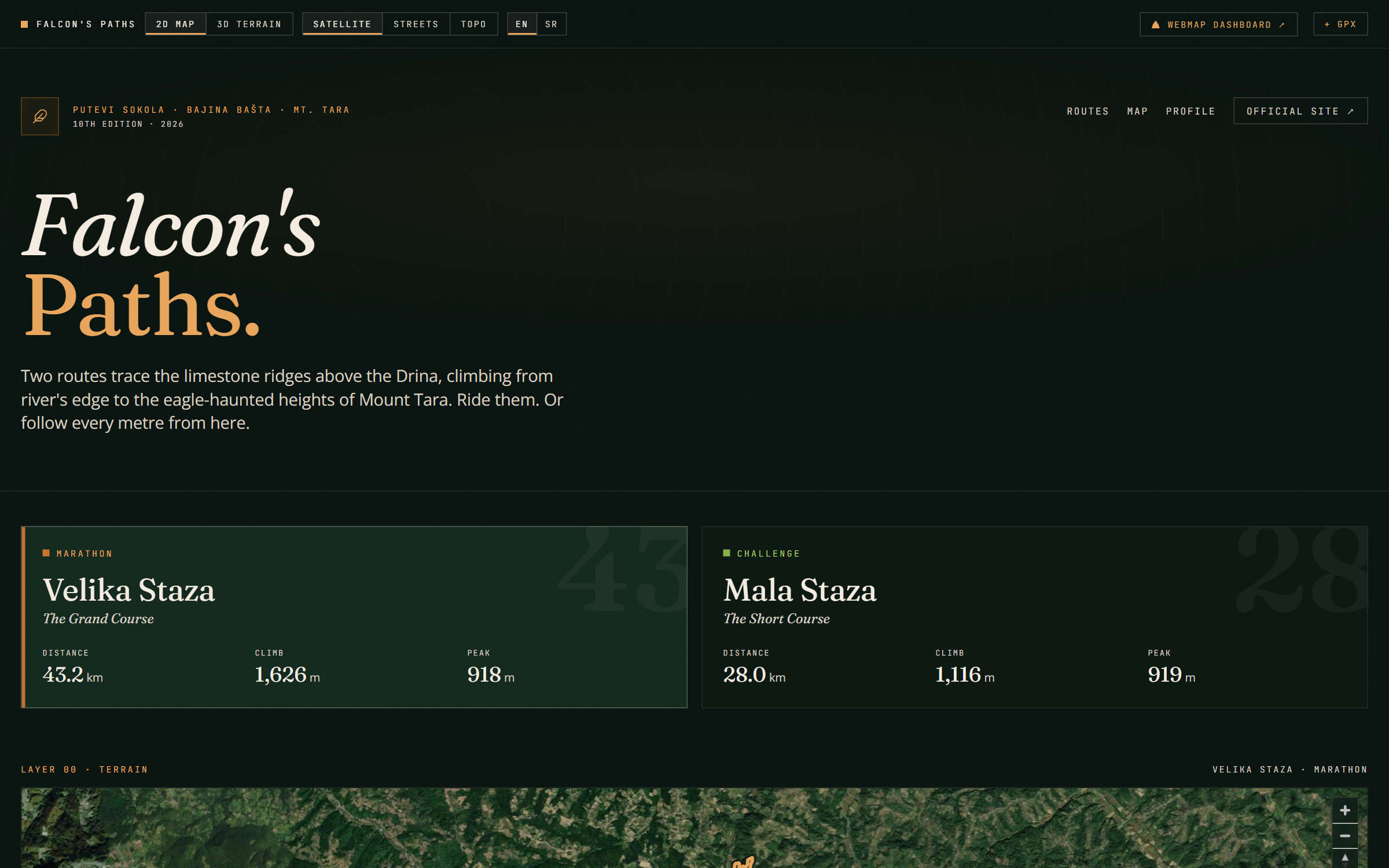
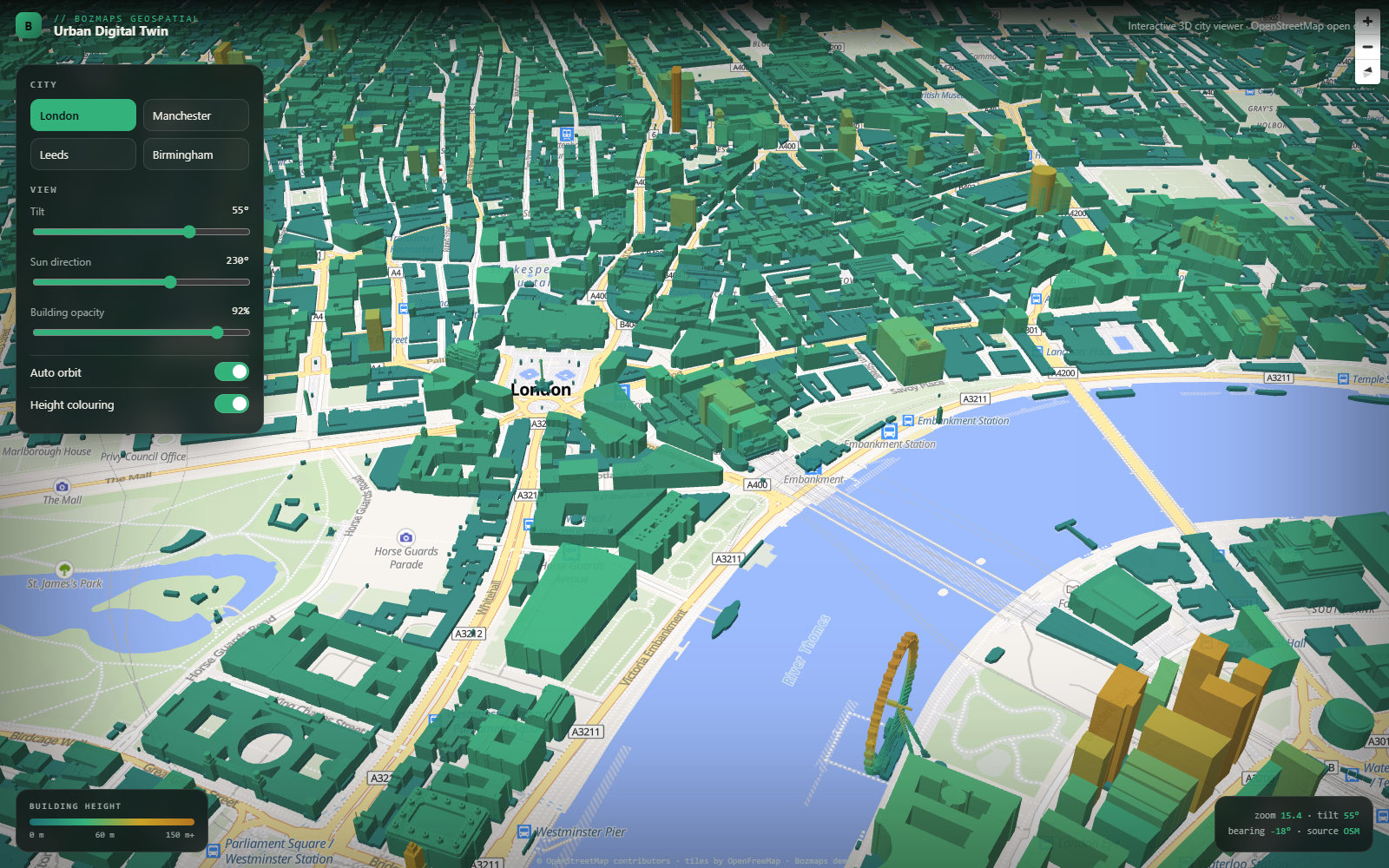
- 2-D and 3-D web maps (terrain, satellite, topographic basemaps)
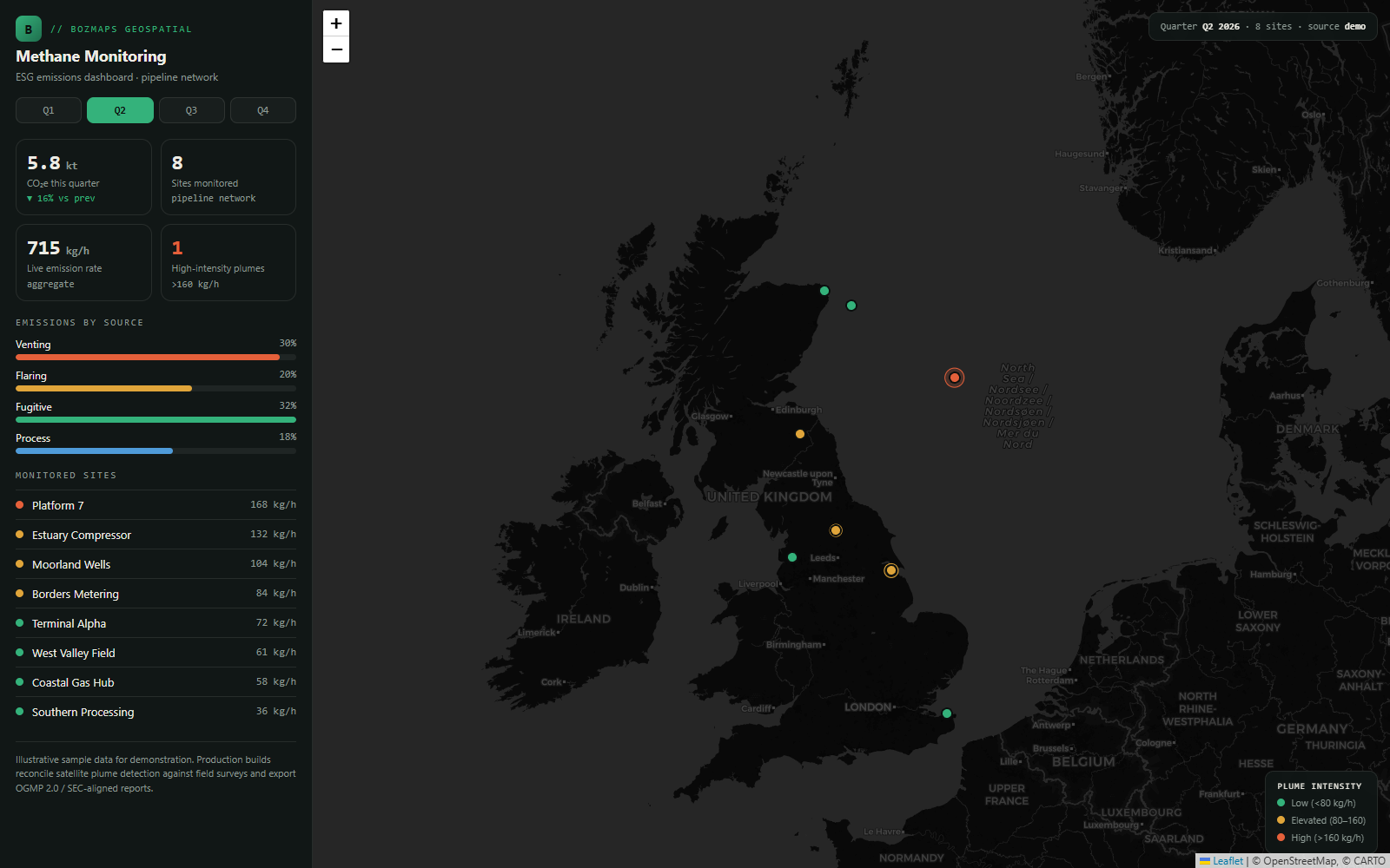
- Spatial dashboards with charts, filters and per-layer controls
- Open-data integration (OS OpenData, OSM, ONS, Copernicus)
- Drone-survey deliverables (orthomosaics, DSM/DTM, GeoTIFF)
- Embeddable widgets and GPX/GeoJSON exports
Councils case studies
Real projects we've delivered for uk councils and local-authority teams.
Other services for councils
- Mobile Apps for Councils
- SaaS & Web Platforms for Councils
- Websites & Marketing Sites for Councils
- Hosting & Long-term Operations for Councils
- AI Features & Automation for Councils
Geospatial & GIS for other UK industries
Building geospatial & gis for councils? Let's scope it.
30-minute call. Written proposal within five working days. Fixed price wherever the scope allows.