GIS & Geospatial Software for Trades
Web maps with MapLibre GL, Leaflet, Mapbox or OpenLayers. Spatial analysis with QGIS, PyQGIS, GeoPandas and GDAL. Drone survey processing. Satellite imagery analysis on Google Earth Engine. We bring real GIS rigour — CRS handling, projections, OS / OSM / ONS / Copernicus data — and ship it as something a non-technical user can operate.
Why UK trades and field-service businesses pick BozApps for geospatial & gis
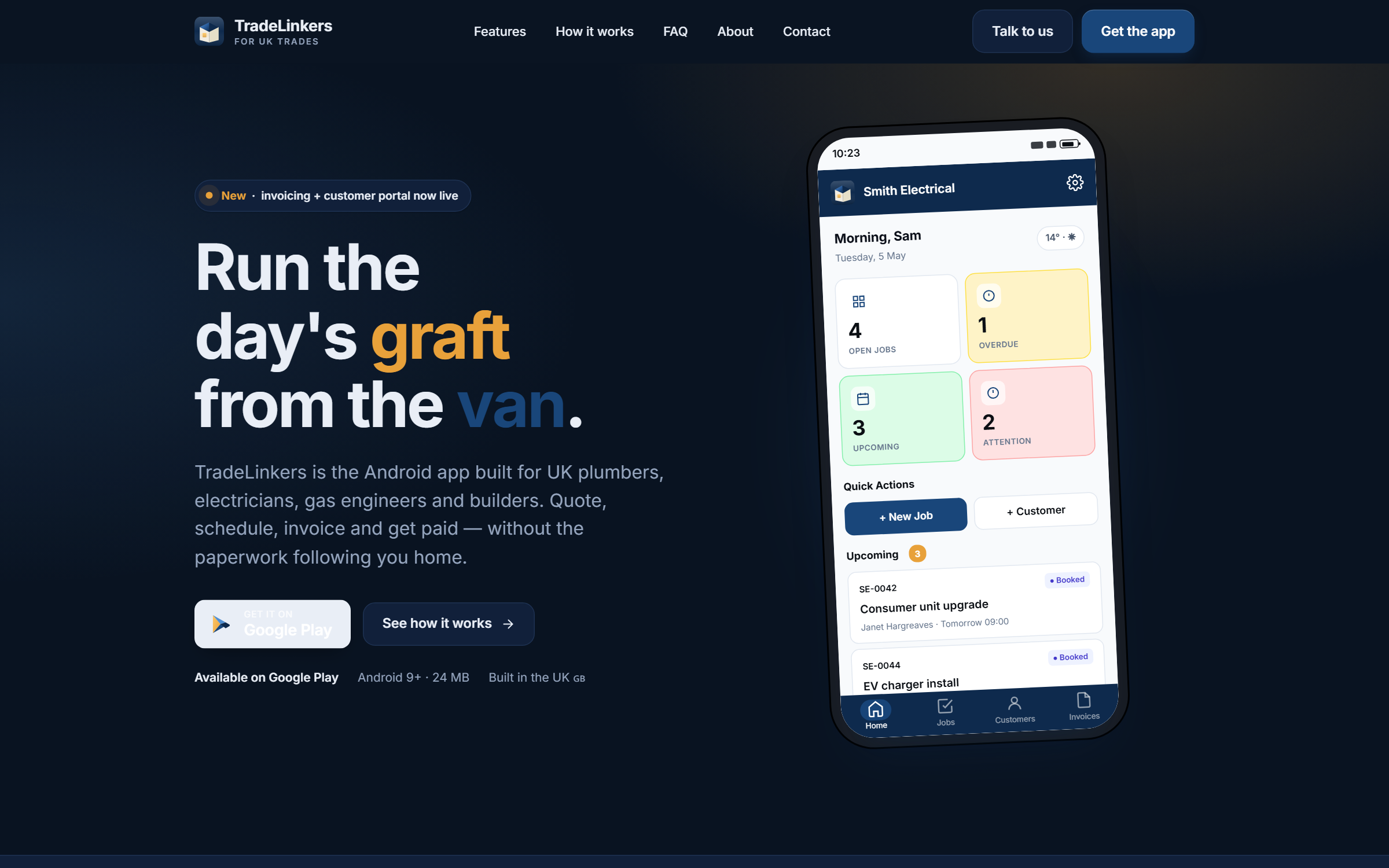
UK trades and field-service businesses don't need generic agency software. They need apps and platforms that work on a rugged Android in poor signal, capture proof-of-work cleanly, integrate with the tools the office already runs, and don't try to be everything to everyone. BozApps builds for the trades sector with TradeLinkers heritage baked into every project.
TradeLinkers heritage — multi-tenant Android-first SaaS for UK trades
Offline-first sync that survives no-signal sites
Camera-heavy workflows for proof-of-work and portfolio capture
Stripe subscriptions and per-job billing wired in from day one
Push notifications for jobs, quotes, payment confirmations
Native Kotlin + Compose for performance on mid-range Androids
Good for trades…
- Local authorities and planning consultancies
- Environmental and engineering teams
- Tourism boards and event organisers
- Research institutions and NHS commissioners
What you'll get
- 2-D and 3-D web maps (terrain, satellite, topographic basemaps)
- Spatial dashboards with charts, filters and per-layer controls
- Open-data integration (OS OpenData, OSM, ONS, Copernicus)
- Drone-survey deliverables (orthomosaics, DSM/DTM, GeoTIFF)
- Embeddable widgets and GPX/GeoJSON exports
Trades case studies
Real projects we've delivered for uk trades and field-service businesses.

Other services for trades
- Mobile Apps for Trades
- SaaS & Web Platforms for Trades
- Websites & Marketing Sites for Trades
- Hosting & Long-term Operations for Trades
- AI Features & Automation for Trades
Geospatial & GIS for other UK industries
Building geospatial & gis for trades? Let's scope it.
30-minute call. Written proposal within five working days. Fixed price wherever the scope allows.