
GIS & Geospatial Development in London
Web maps with MapLibre GL, Leaflet, Mapbox or OpenLayers. Spatial analysis with QGIS, PyQGIS, GeoPandas and GDAL. Drone survey processing. Satellite imagery analysis on Google Earth Engine. We bring real GIS rigour (CRS handling, projections, OS / OSM / ONS / Copernicus data) and ship it as something a non-technical user can operate.
Why London businesses pick BozApps for geospatial & gis
BozApps works with London-based businesses across fintech, property, hospitality and consumer SaaS. We're a remote-first studio with regular in-person meetings in Central London, and the kind of fixed-price engagement model London founders prefer over the open-ended day rates that dominate the rest of the market.
London property work, case study: Pulat Estates
Used to Tier-1 agency pricing without Tier-1 agency overhead
Familiar with London-specific procurement (estate agents, hospitality)
Easy in-person meetings, central London or wherever your office is
Good for London…
- Local authorities and planning consultancies
- Environmental and engineering teams
- Tourism boards and event organisers
- Research institutions and NHS commissioners
What you'll get
- 2-D and 3-D web maps (terrain, satellite, topographic basemaps)
- Spatial dashboards with charts, filters and per-layer controls
- Open-data integration (OS OpenData, OSM, ONS, Copernicus)
- Drone-survey deliverables (orthomosaics, DSM/DTM, GeoTIFF)
- Embeddable widgets and GPX/GeoJSON exports
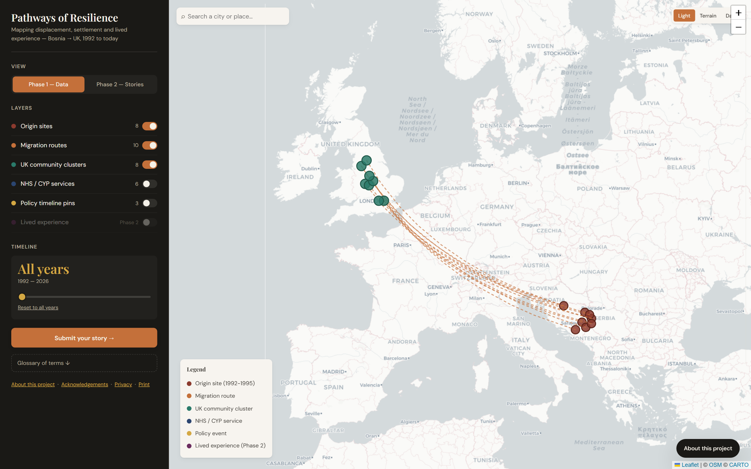
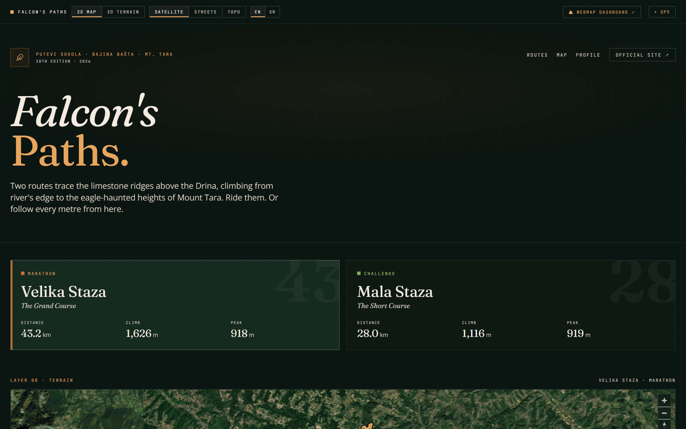
Shipped examples
Real geospatial & gisprojects we've delivered for UK clients.
Questions London businesses ask us
Straight answers, real numbers. Anything else, just ask on a free 30-minute call and you'll have a written proposal within five working days.
What geospatial work do you actually do?
Interactive web maps with MapLibre, Leaflet and Mapbox, spatial dashboards, QGIS and Python analysis, drone-survey processing and satellite imagery work, all delivered as tools non-technical teams can operate.
Do you work with councils and public bodies?
Yes. We have local-authority experience through Bozmaps, build to WCAG 2.2 AA accessibility standards, and are used to public-sector procurement timelines.
What data can you work with?
OS OpenData, OpenStreetMap, ONS and Copernicus among others, with proper CRS and projection handling, alongside your own survey, asset or customer data.
Can the map be embedded in our existing website?
Yes. Embeddable widgets and GPX/GeoJSON exports are standard deliverables, so the map works inside whatever platform you already run.
How is a London project priced?
Fixed price after a free 30-minute call, with a written proposal within five working days. No day-rate creep mid-project.
Want the plain-English version of how an engagement works? Create a website or dashboard for your organisation
Geospatial & GIS in other UK cities
- Geospatial & GIS in Manchester
- Geospatial & GIS in Birmingham
- Geospatial & GIS in Edinburgh
- Geospatial & GIS in Leeds
- Geospatial & GIS in Bristol
- Geospatial & GIS in Glasgow
- Geospatial & GIS in Liverpool
- Geospatial & GIS in Newcastle
- Geospatial & GIS in Sheffield
- Geospatial & GIS in Nottingham
- Geospatial & GIS in Cardiff
Other services in London
Based in London? Let's scope your geospatial & gis project.
30-minute call. Written proposal within five working days. Fixed price wherever the scope allows.